


The trip started out with leaving late Friday at 3:30pm to head up to Cedar Break and to park, then headed out across the dam heading east (counter clockwise) to allow the miles to count down as I went.
Obviously it wasn't long before the sunset occurs still due to early nights still, can we please end DST and fix this mess? It was a nice relaxing dusk hike to the first camp ground and a chance to relax.
Check Out My Lighterpack for gear details
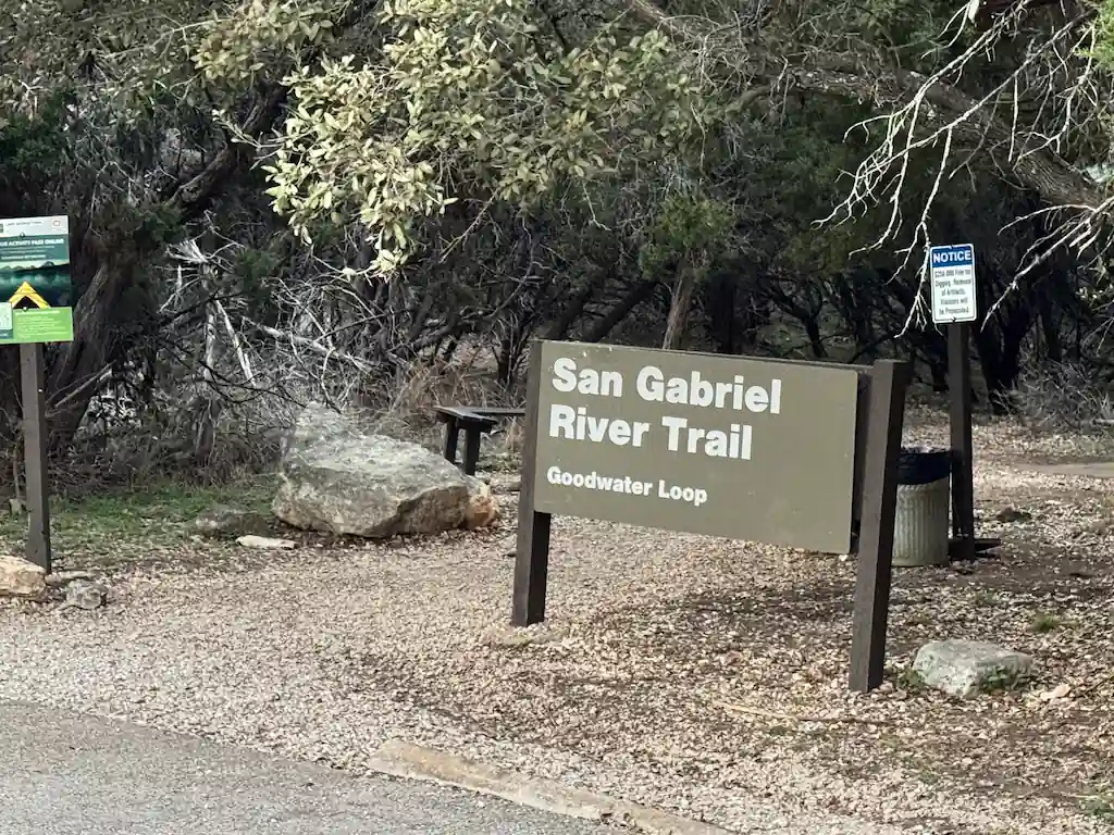
Good Water Loop Primitive Camping
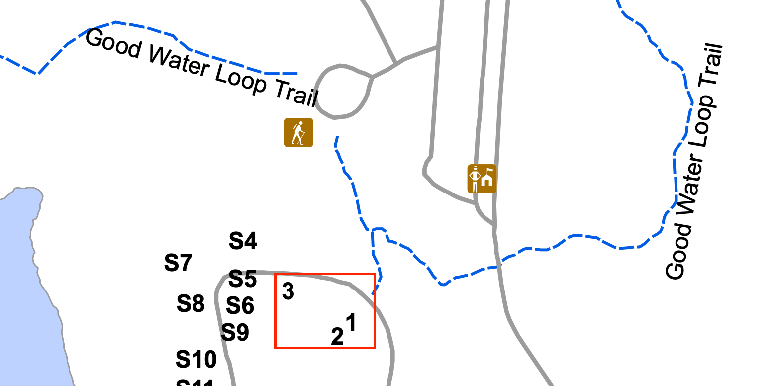
Before we dive in too deeply, there are 3 very primitive campsites without potable water, some have access to the lake but filtering form a human boat water source to me is highly questionable.
On this trail you can't choose to camp wherever you want, there is no stealth camping just off the trail, nor is there many places on the trail where I think that could ever be viable due to the harsh rocky terrain in many places.
I would suggest taking advantage of the paid camping sites to get water from faucets, bathrooms, and in some cases showers if you are needing it.
Day Zero - Travel to Cedar Breaks Park
I left late on Friday at about 330pm from Katy as I needed to wait for my friend to get through their work day. The drive to Round Rock is around 2.5-3 hours depending on traffic and time of day for us to reach the Cedar Breaks parking lot.
Leaving at 3:30pm got us there at right around 630pm with nightfall already kicking in we took off towards the dam at 645.
Crossing the Dam
I can say that since this was at night we didn't have issues with long sun exposure on hot concrete, since we were fresh legged the crossing to me was fairly easy, if somewhat boring.
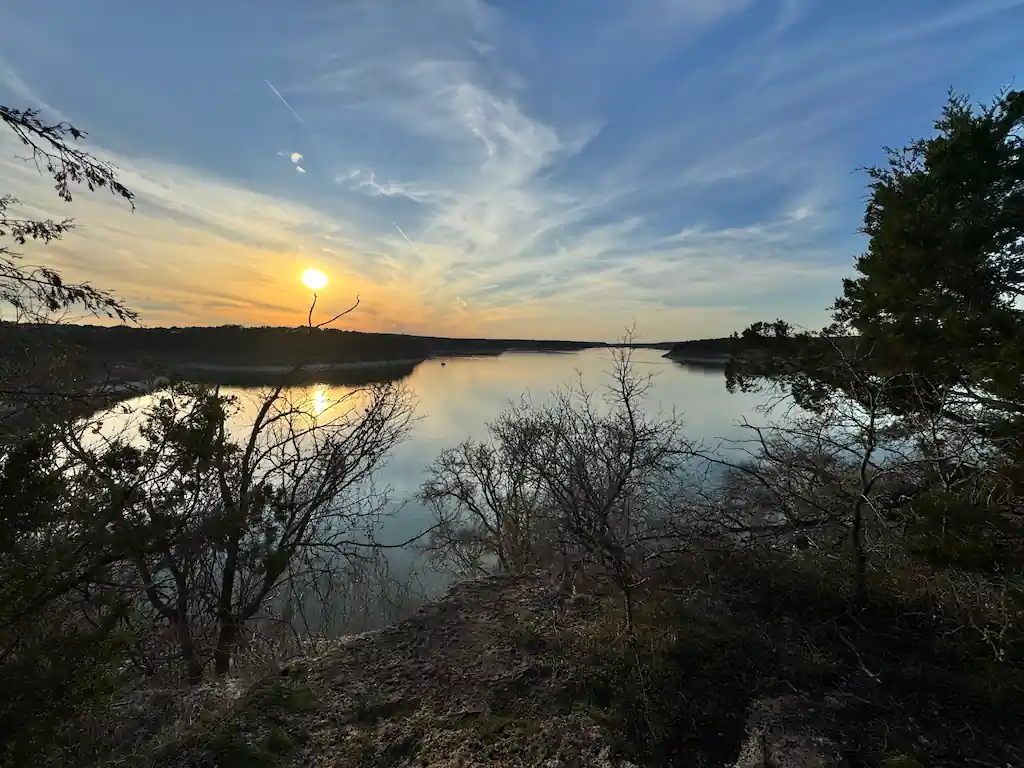
Beneficially we were able to see the stars very well and all the planets in their once in a lifetime display all out there to enjoy, that part I enjoyed a lot and would say the trail has very little light pollution so viewing the sky is outstanding.
Learning to Enjoy Night Hiking
While I have camped loads on backpacking trips I have typically avoided late night hiking choosing to finish early and setup camp and to start early in the morning, this time the trail and timeframe offered a chance to really embrace the night.
As I have never night hiked before this was a totally new thing and I can say confidently afterwards I really enjoy night hiking. There is something way more mysterious to the forests and trails at night time and with Texas a nice drop in the overall temperature allowing for more effort but less sweat and less water needs.
Night hiking took us through the Overlook area which has really nice crushed rock trails which are pretty comfortable to hike on, but we were focused on Walnut Springs so we continued on pressing to get to Jim Hogg and through the paid campsites.
Hitting Pure Exhaustion at 10 Miles
We had planned to make it to Walnut Springs to camp but that is about 12 miles in and by mile 9-10 we were full on burned out. Gassed from a day of working, 3 hours driving and then hiking for nearly 5 hours.
We were close to Russell Park Campground and since this trail has very good cell coverage I was able to access the recreation.gov website where you have to book campsites and I was able to get site 2, I very much recommend this site as it is barely off the trail and offers bathrooms, water, trash, and showers.
The sites are also very large and your close enough to get to the bathroom but not so close as to have constant traffic of people going to it throughout the night.
While we were exhausted and were setting up camp we began joking about trying to complete the whole loop thru-hike in under 24 hours. We laughed and called ourselves silly but the thought continued to rattle in my brain throughout the night of sleep and by the morning I was convinced that would be the approach for the day.
Day One - Chaos Sparks And We Change Tactics
We agreed in the morning to hike on and see how we felt when we hit Tejas, we promised each other that we would take a real hour long break there to rest up. From Russell Park to Tejas is very open to the sky and full on sun would become something we wish this trail would think about, plant some more trees and get the shade covering more trail!
The trail to Tejas from Russell Park is also flat and is more a old fashion dirt road that doesn't look to be driven on very often, I assume its now only for service and maybe ATVs. Over these five miles the sun continued to climb higher and higher into the sky and the heat, which was projected to be in the low 70s just grew and grew until it peaked about 83 degrees just after 1pm which was even hotter than I imagined.
Tejas Park
The trail drops down into Tejas Park over a concrete bridge which goes over the river and really was looking good enough to just jump into. We chose not to though and instead headed to the group camping spot (S11) which is the last covered picnic bench are before back on the trail.
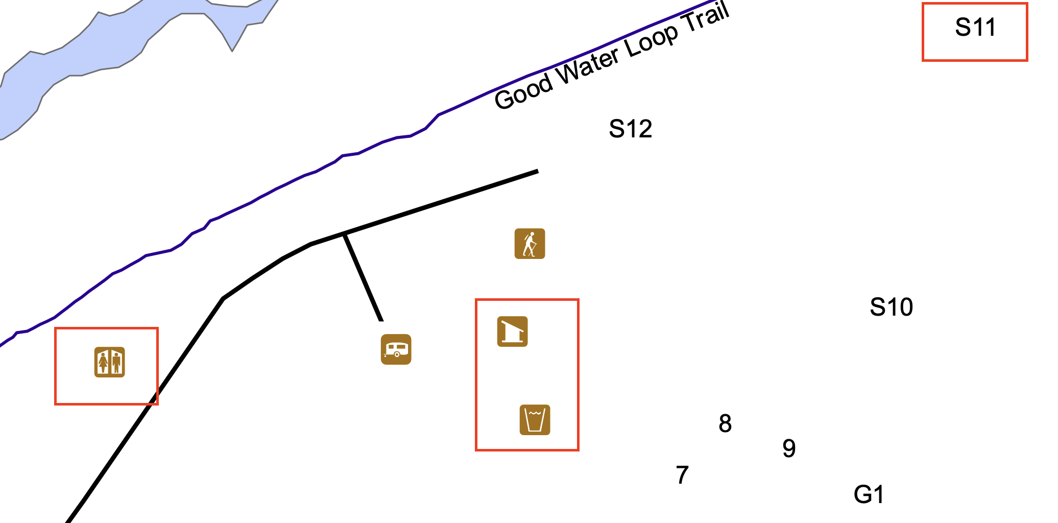
We wanted to use this to get out of the 80 degree heat for a bit while eating lunch and elevating our legs to get as much recovery time in as we could. There is pit toilets for men and women, trash cans, and a water spigot next to the trash to refill water as much as you need, I suggest cameling up as from this point forward there appears to be very little water available.
As we rested we decided we liked our "hiker math" plan to just complete the trail tooday as we had a perfect chance to finish the entire trail in less than 24 hours. This meant we had 11 miles to go and we both thought the challenge would be amazing.
By hiker math, we decided that our hike to Sawyer Camp would complete by or before 3pm which is too early to decide to setup camp. Due to that fact Cedar Hollow was only about 2 miles after so maybe 4pm, this would also be too soon. So without another camp option the only real answer would be to push to the car and completion.
Now, as to water, I bet someone will say "you're near the lake" but for much of the next 11 miles to the Cedar Breaks you are actually not very close to the water to refill easily. So we both cameled up with all we could drink as well as brought 2 liters each, unsure if there was any easy water while also heading into what we knew would be the hottest part (83 degrees) of the Texas day.
Putting In Some Very Exposed Hiking
As neither of us have hiked this trail before we were hoping there was a lot of hiking in the trees to help cut down the direct sun exposure. I can tell you we were drastically wrong here and we were in direct exposure for the next 7 miles pretty continuously, this is a trail where a sunbrella could make a lot of sense if you like the shade.
It is near five miles from Tejas to Sawyer and through this stretch there was maybe a couple hundred feet of real sun coverage on the trail itself, so expect to get good sunscreen use and to need to hydrate more often!
I do think this section was pretty though and the grasslands and surrounding hills could be amazing if it was a little cooler or maybe there was any breeze to speak of.
Grinding Into Sawyer Campground
As we started to believe this campground didnt exist, it was poorly marked overall and is closer to the end of the "Sawyer Area" on AllTrails. Once we ran into it we were tired, sweaty, and ready for a break.
Since we weren't aware of any water at Sawyer Camp proper we chose instead to find shelter from the sun under a tree close to the split from the main trail and just took a 20 minute siesta getting in some food, water, and rest using our packs and my GG Thinlight to lay down and rest up for the race we had to beat the sun and 24 hours.
After resting up we packed back up to begin the race to the end, now it was going to become a battle of the mental strength over physical deficiency.
Racing To Cedar Hollow
While its only about 2 miles to this camp from Sawyer our bodies were starting to hate us with numerous aches and pains beginning to win over the Vitamin I we took to combat it.
While our GPS told us we were maintaining 2.6 miles an hour it felt like it was at least an hour to reach the next camp and when we reached it we passed on by as there was tents and what looked like 18-21 year olds playing loud music and not the epitome of backpacking quiet.
This is when you finally start climbing back up into the hills and you begin to have a lot more sun coverage which was blissful when you are exhausted from the 7 mile trek through beating sun.
We skipped camp and told ourselves when we reached mile marker three we would take our final break to hopefully recover enough to attack the final 3 miles without running out of steam.
The Final Push To The Car
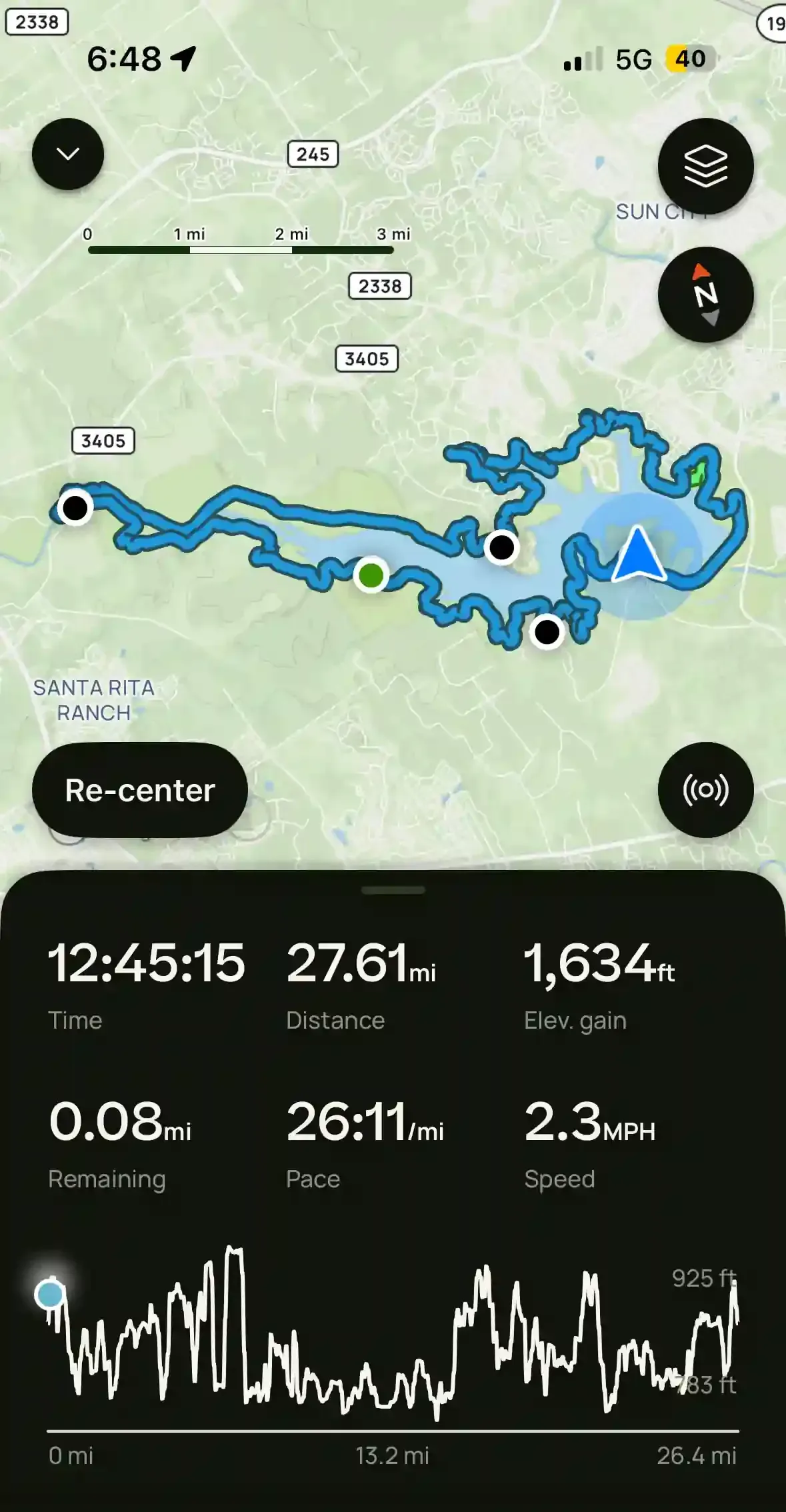
We hit mile marker 3 close to 430-445pm and knew it was going to be close to hit our 24 hour mark which we had recorded as 6:48pm when we started the previous night.
We took a limited 15 minute break to get as much rest in as possible, eat and drink and mentally prepare for the last 3 miles as race to the car.
It took the full next two hours to reach the car, honestly tagging it at 646pm and only barely cutting in under the line but we did add in a side track to Crockett Garden Falls also. The last 2 miles being a brutal warfare on our feet and knees with rocks and unstable and rocky ground finally showing the wear and tear on us over the previous 25 miles.
We looked hobbled and beat, with people passing us left and right on the trail, most not paying a second thought to us. All we had in our minds was to beat the timer we self created and to not be defeated by the trail itself.
I swear the last .5 miles literally took an hour to finish, it was the hardest thing I've done in a long time to walk when the body was literally telling me to stop and take the load off.
I am not that person, don't be that person, strive and achieve greatness in whatever you choose to do. Even if you arent a backpacker, hiker, thruhiker, find the thing you love and truly excel as it feels amazing.
Water on the Good Water Loop Trail
Along the trail are plenty of options to fill up with potable water which means there is no need to filter lake water but I carried my filter in case. I tried to carry 16-32 ounces of water at a time which was great for Spring between fill-ups.
If you plan on doing the Good Water loop during the summer you may need to filter lake water once (between MM 0 and Tejas Park MM 11) otherwise 2L each got us through the first night (Russell Park) and after refilling there easily to Tejas park the next day.
Once at Tejas on a counter clockwise make sure to carry enough water to get to Sawyer Camp where you would need to filter from the lake.
Good Water Loop Trail Tips & Need to Know
Stealth Camping is Prohibited– it is required that you stay at either one of the established campgrounds or one of the primitive campgrounds. Stealth camping is prohibited along the trail.
Bring plenty of water – Depending on the section you will be hiking and time of year, water sources could be 7-10 miles apart.
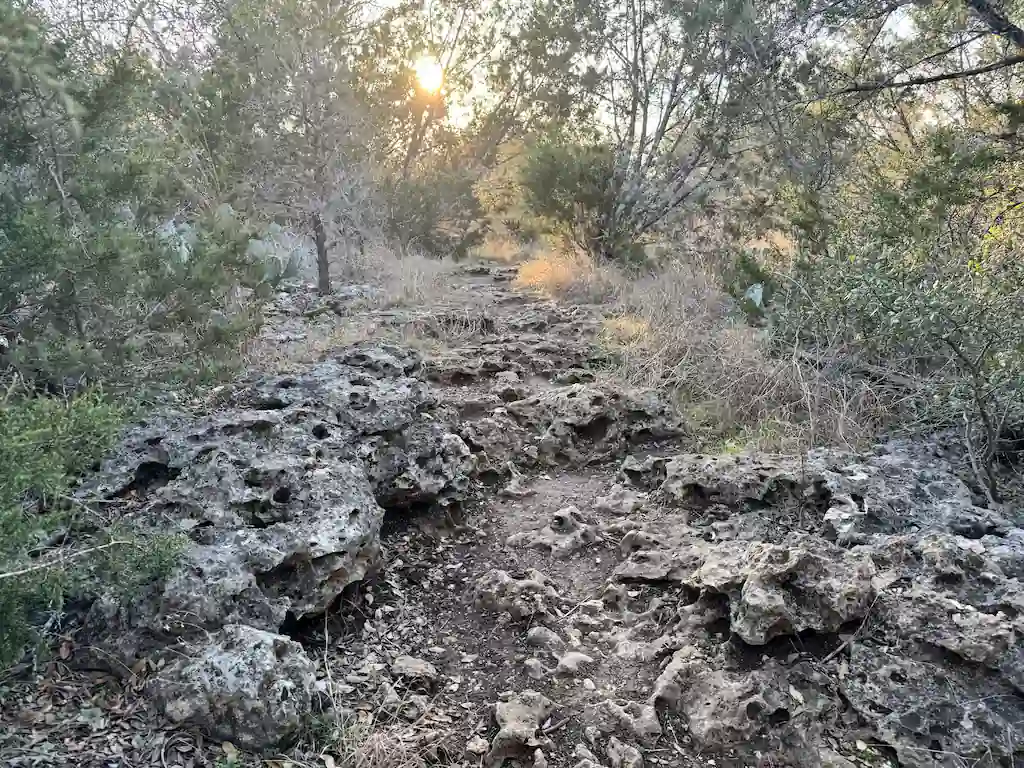
Wear good trail runners or boots – The trail is at times really rocky, good ankle support is probably helpful and maybe needed unless you have really strong ankles.
Bring your camera – The trail offers some beautiful views and beautiful scenery. iPhones just don't do it justice but can always work in a pinch.
Bring a map & compass – The trail is not marked well, it is at best loosely marked with trail markers every mile and it is easy to veer off the trail onto what will look like the main trail, like we did in the Overlook area.
Don’t Forget the 10 Essentials – As with any hike, always make sure you are carrying at a minimum your 10 essentials.
Good Water Loop Maps & Info
TRAIL MAPS
Trail Map || Topo Trail Map || CalTopo || AllTrails
CAMPGROUND MAPS
Cedar Breaks || Jim Hogg || Russell Park || Tejas Park


